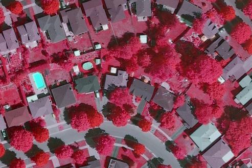
From satellites gathering imagery from hundreds of miles above the Earth's surface to aerial systems mounted with lasers capable of generating 3D maps with centimeter accuracy, we're gathering more data about our Earth from above than ever before. This course will help you make sense of these complex and exciting datasets. Whether your interest is in natural disasters, environmental assessment, or national security, we'll give you the tools, methods, and techniques to extract actionable and meaningful information from these data. This course will help you understand that an image is more than just a pretty picture.
At a Glance
Details
| Credits |
3.00
|
|---|---|
| Topics |
Fundamentals of GIS and Mapmaking
Geospatial Intelligence
Remote Sensing and Image Analysis
|
| Technologies |
Amazon Web Services
ArcGIS
ArcGIS Online
ArcGIS Pro
eCognition Developer
|
| Syllabus | GEOG 883 Sample Syllabus |
Upcoming Offerings
| Semester | Instructor |
|---|---|
| Summer 2026 | Jitendra Bal (JB) Sharma, Ph.D. |
| Fall 1, 2026 | Bradley Doorn, Ph.D. |
| Spring 1, 2027 | Jitendra Bal (JB) Sharma, Ph.D. |
| Summer 2027 | Jitendra Bal (JB) Sharma, Ph.D. |
Meet Our Faculty Instructors
What Our Students Say
GEOG 883 was an essential step in my growth.
“GEOG 883 was an essential step in my growth as a practitioner in the field of Conservation GIS/RS. The course gave me a sound foundation in OBIA, which produces more accurate results in classifying medium- to high-resolution imagery than traditional pixel-based methods. I'm using it every day to create land use/land coverproducts for use in mapping, analysis and modeling.”
— Natasha Gregory-Michelman