WE ARE proud of the unique contributions, talents and skills of our faculty and students.
Recognition and Awards
Our faculty and students are often recognized for their important contributions to the field, from winning academic awards to publishing papers in prestigious journals.
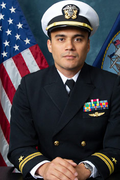
Todd Greenwood (MS - Spatial Data Science) Receives Civil Air Patrol Award for Helping Disaster Victims
Todd Greenwood (MS - Spatial Data Science) Receives Civil Air Patrol Award for Helping Disaster Victims
Todd M. Greenwood, a recent Spatial Data Science graduate (MSc. 2023), recently put his newly-acquired geospatial analysis skills to excellent use in helping obtain federal disaster relief funds to hurricane victims in Florida.
Working with both FEMA and the Civil Air Patrol, he was part of a national disaster imagery assessment response team that quickly and accurately identified structures that qualified for federal disaster assistance.
The FEMA/CAP program, which enables CAP volunteers to receive and apply specialized disaster imagery assessment training, is both unique and extremely valuable as part of an overall national emergency response framework.
As part of his efforts, Greenwood was awarded the CAP National Commander's Commendation Award for outstanding duty performance. Says Greenwood, "I would like to humbly extend my thanks to both the Charleston, SC and Hanscom, MA squadrons, as well as Scott Kaplan's national CAP response team, and of course Penn State for providing me with the tools and support to help our fellow Americans in need. WE ARE!".
Congratulations Todd!

MGIS Student Cathryn Hunt Receives ESRI Innovation Program Student of the Year Award
MGIS Student Cathryn Hunt Receives ESRI Innovation Program Student of the Year Award
MGIS graduate Cathryn Hunt received the Esri Innovation Program 2024 Student of the Year Award. Our program is one of a small number of academic units around the world recognized as a participant in the Esri Innovation Program (EIP). The EIP seeks to promote GIS software and application development by providing students special access to Esri software and opportunities to be recognized for their accomplishments. Each academic program nominates a student, and Ms. Hunt received the overall award.
Her capstone research project, "From Selfish to Selfless Routing," addressed traffic congestion through innovative GIS routing applications.
Recent previous EIP Student of the Year nominees from Penn State are:
2023 - Libbie Duskin
2021 - Sue Panton
2020 - Gene Trantham

Todd Bacastow Selected for Emeritus Academy
Todd Bacastow Selected for Emeritus Academy
Teaching Professor Todd Bacastow was recently accepted into the Emeritus Academy at Penn State. The Emeritus Academy was “founded to promote the ongoing engagement of Penn State emeriti faculty in both scholarly and creative activities. It seeks to promote scholarly community among emeritus faculty, provide connections to keep emeritus faculty connected to the University, enhance the reputation of the University, and to benefit society at large.”
Here is a note from Professor Bacastow about his goals while in the Academy:
“It's a sad yet undeniable reality that conflict often drives innovation. The Emeritus Academy facilitates my studies of the innovations in geospatial technologies resulting from the Russia-Ukraine conflict. Recognizing and conveying the learnings from this conflict play a vital role in the sustained evolution of Penn State's online educational offerings. The research serves as a compass, directing the programs toward recent innovations and helps to solidify Penn State's reputation as a pioneer in the geospatial field.”
MGIS Student Yousre Odeh Wins Esri Special Achievement in GIS Award
MGIS Student Yousre Odeh Wins Esri Special Achievement in GIS Award
MGIS student Yousre Odeh, through his work with the City of Wilmington, Delaware’s Public Works Department, was one of the recipients of the 2023 Esri Special Achievement in GIS award. The winning organizations for the award "set new precedents throughout the GIS community" (ESRI). Mr. Odeh is the project manager for Wilmington’s innovative efforts to improve the city's aging water distribution infrastructure by identifying water mains for replacement, sharing findings with stakeholders, and efficiently documenting the installation of new mains.
Lt. Michael P. Murphy Award
Named in honor of Lt. Michael P. Murphy, USN, a Medal of Honor recipient and distinguished Penn State alumnus, this award recognizes achievement by a Penn State Online Geospatial Education Master’s degree student who has served in the U.S. military or with the geospatial intelligence community and demonstrated exceptional contributions to the discipline.
The Lt. Michael P. Murphy Award in Geospatial Intelligence is sponsored by Maxar, USGIF, Todd and Barbara Bacastow, Alan W. Scaroni (dean emeritus of the Penn State College of Earth and Mineral Sciences), and Richard DiEugenio, former special assistant to the president for governmental affairs in Penn State’s Office of Governmental Affairs.
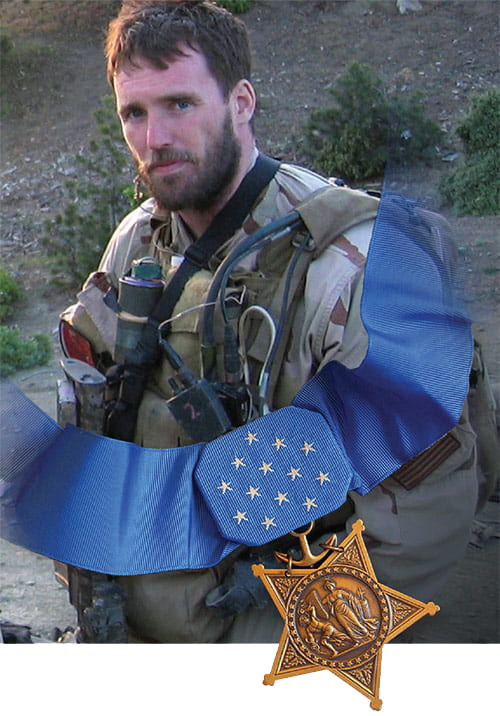
Lt. Michael P. Murphy was a member of Penn State’s class of 1998 and the first University alumnus to be awarded the Medal of Honor, the United States’ highest award for military valor. A Navy SEAL, Murphy received this singular distinction posthumously for his courageous actions in 2005 during the war in Afghanistan.

2025 AWARD RECIPIENT: Inori Hayashi
Inori Hayashi is the 2025 honoree of the annual award that recognizes a Penn State student who has made exceptional contributions to the global geospatial intelligence community.
Hayashi served in the Marine Corps for five years and is an associate at defense contractor Booz Allen Hamilton, where she serves as a Japan Operations Branch Linguist for III Marine Expeditionary Force G-357. Hayashi is pursuing a master’s degree in homeland security with a concentration in intelligence and geospatial analysis online through Penn State World Campus.
The Lt. Michael P. Murphy Award honors Navy SEAL Lt. Michael P. Murphy, a Penn State alumnus who was killed on June 28, 2005, during a reconnaissance mission in Afghanistan and was posthumously awarded the Medal of Honor for his heroic actions.
Previous Lt. Michael P. Murphy Award Recipients
The Lt. Michael P Murphy Award has recognized many talented students in recent years. Previous recipients are listed below.