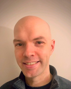
“The challenging lessons, timely instructor feedback, and using personal interest topics for final projects kept me engaged and motivated.”
A Chat with Dave
Let us know a little about yourself, your current employment, and how you ‘found’ GIS.
Where I grew up, in Rochester, NY, there wasn’t much of a job market for people like me who had a ‘not-so-hot' anthropology undergraduate degree. I also had simmering interests in public health and epidemiology and had plans to pursue graduate studies in those fields to better my chances of starting a professional career. When I got laid off in 2009, I moved to the Washington, D.C. metro area to take a job in population health, thus putting my education pursuits on hold. After a few years of financial stability, I applied to a few Master of Public Health programs, to which I was rejected. While expressing my disappointment to co-workers, they told me about courses in GIS that they taken. I had never heard of GIS, but after Googling what it was, I discovered that my interest was piqued. I sat down with the program chair of the University of Maryland’s MPS in GIS program and walked away with the determination that it was going to be my next pursuit. Today, I’m employed as a GIS Developer for the University of Kansas primarily managing a statewide geospatial clearinghouse and collaborating with Kansas state agencies on their projects.
What did you appreciate about your experience with Penn State's online geospatial education program?
What I found most beneficial was being able to work full-time, balance life responsibilities and hobbies, and have the freedom to work on schoolwork when and where I chose to. The flexibility of the asynchronous style of the program, along with the relevant nature of the course topics, were the main drivers of selecting Penn State's Geospatial Programming & Web Map Development certificate program. When working on coursework, I found the challenging nature of the lessons, timely feedback from instructors, and the ability to use personal interest topics for final projects, to all be attributes that kept me engaged and motivated.
How do you plan to use/apply your certificate, and how have you been using the skills gained from your coursework so far?
One of the reasons I pursued this program was to get myself out of what seemed like a plateau in a former job position. I felt I needed more skills if I was going to change jobs at some point and I wanted those skills to be more programming and development-focused. During the second course I took, the TA posted a job for a GIS Developer position at the University of Kansas, to which I applied, and then was offered. The plan was to use the certificate to get a better position once I completed the program; it just ended up happening much sooner than I expected. My position with KU is much like a combined review of all the courses I took at Penn State. I’m always surprised at how relevant the skills I learned in the program ended up transferring to the real-world right away.
Do you have any advice for incoming students or students considering online geospatial education programs at Penn State?
GIS is a technical field. Period. You need skills to understand what GIS is about and how to use it effectively. If you’re considering pursuing Penn State's geospatial certificate programs, know that you will be exposed to a lot of different skills, applications, data models, technologies, and programming languages that are relevant and timely. GIS is a tool and is subject-agnostic, so the skills and lessons you will take away will persist wherever you go.
Thank you Dave! If you have questions about our program, please send a message to info@gis.psu.edu and we would be happy to talk with you!
Read about some of our other amazing students, or email us to share your own story!