My goal is to provide a meaningful curriculum to educate the current and future workforce and enable the use of remote sensing technology for the betterment of society and our planet.

Contact Karen
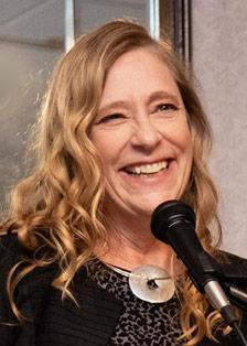
Karen Schuckman is an associate teaching professor in Geography at Penn State, where she teaches remote sensing and geospatial technology in the online GIS programs offered by the John A. Dutton Institute for Teaching and Learning Excellence. She also serves as the Executive Director of the American Society for Photogrammetry and Remote Sensing (ASPRS) and provides consulting services as the President of Seven Valleys Consulting, LLC.
Karen began teaching Geog 883 in the Penn State Online Geospatial Program in January 2007, and over the past 15 years developed the Remote Sensing and Earth Observation Graduate Certificate curriculum, consisting of five 3-credit courses and engaging the services of four part-time faculty who have extensive teaching as well as professional practice experience.
As the geospatial technology leader at URS in 2005–06, Karen supported response, recovery, and mitigation projects with FEMA following Hurricanes Katrina, Rita, and Wilma. From 1995 through 2005 she was with the EarthData group, where her positions included geospatial applications director for EarthData Solutions, senior vice president of EarthData Technologies, and president and general manager of EarthData International of North Carolina. Notable projects she led for EarthData include lidar acquisition for the North Carolina Floodplain Mapping Program, numerous transportation mapping projects for state DOTs, and technology demonstration projects for NOAA, NASA, and the U.S. Department of Transportation. Prior to joining the private sector, Karen worked for the USGS National Mapping Division in Menlo Park, California. She has also served as vice chair of the NOAA Advisory Committee for Commercial Remote Sensing, and a member of the National Research Council Committees on Floodplain Mapping Technologies and FEMA Flood Map Accuracy.